

Measuring systemLeica Geosystems
BLK3D




Grunnupplýsingar
- Heiti vélar:
- Measuring system
- Framleiðandi:
- Leica Geosystems
- Gerð:
- BLK3D
- Framleiðsluár:
- 2023
- Ástand:
- nýtt
Verð og staðsetning
- Staðsetning:
- 371 Chemin des Clauzes, 82160 Saint-Projet, France
Tæknilegar upplýsingar
Skjöl og vottun
Tilboðsupplýsingar
- Auglýsingarauðkenni:
- A23290590
- Uppfærsla:
- síðast þann 05.11.2026
Lýsing
1 Refurbished Leica BLK3D
1 Cable + charger
1 Battery
1 Microfiber cloth
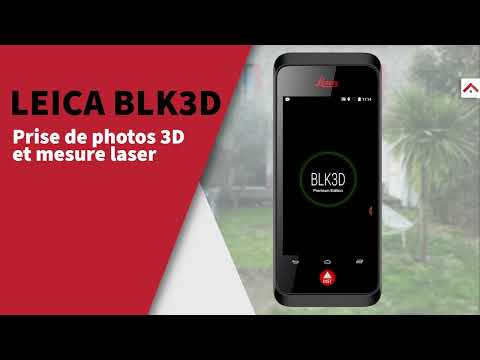
LEICA BLK3D – Professional 3D Photogrammetric Distance Meter
Selling a Leica BLK3D in perfect working condition – the leading photogrammetric measurement tool for professionals in the construction, surveying, and architecture industries.
Description
The BLK3D combines a calibrated stereo camera, measurement sensors, software, and integrated edge detection functions for image-based measurements with professional accuracy. (VERTICAL 3D)
The device is equipped with 2 stereo photo lenses, allowing for 3D measurement of all elements that appear in the photo. (STTL) Each photo taken provides a complete measurement record, including height, width, and depth.
Processing is performed in real time directly within the device (edge computing), without the need for a network connection or cloud services.
Key Features
Integrated photogrammetry: instrument combining a camera, advanced algorithms, and instant processing.
Combined with electronic distance measurement technology.
Auto-targeting: visual recognition technology that allows you to select specific points for your measurements.
Construction site documentation: measure inaccessible areas, create plans, estimate building installations, and document project progress.
Collaboration: share measurements with your colleagues via the BLK3D software (mobile or desktop version), export to JPG, or create PDF reports.
Automatic geolocalization: each image is time-stamped and associated with the exact GPS coordinates of the capture location (Kuker-Ranken).
Bwodpfe Ah E A Tox Ai Rjw
BIM/CAD integration: export to DWG/DXF for use in your CAD software, compatible with Autodesk BIM 360 (Kuker-Ranken).
Technical Specifications
Dimensions
180.6 × 77.6 × 27.1 mm
Weight
480 g
Tripod thread
1/4" (standard photo)
Cameras
2 × 10 MP, 80° angle, 4 mm focal length
Screen
5" IPS touchscreen, 720×1280 px
Processor
Snapdragon 820E Quadcore 2.35 GHz
RAM
4 GB
Internal storage
64 GB (~5,000 stereo photos)
OS
Android 7.1.2
Accuracy (good conditions)
±1 mm
Accuracy (poor conditions)
±2 mm
Maximum range
250 m (good conditions) / 120 m (poor)
Battery
3,880 mAh – battery life ~4 hours
Connectivity
Bluetooth 4.1, Wi-Fi 802.11 b/g/n, GPS+GLONASS
Ideal for:
Architects, surveyors, quantity surveyors, site managers, building inspectors, engineering firms – any professional who needs to quickly take measurements on site or during inspections.
International shipping available at your expense.
- Interested in this equipment?
Contact me via private message for more details or to discuss your 3D digitization needs!
Þessi auglýsing var sjálfvirkt þýdd. Villa í þýðingu gæti verið til staðar.
Bjóðandi
Skráð frá: 2026
5 Auglýsingar á netinu
Senda fyrirspurn
Sími & Fax


 Saint-Projet
Leica GeosystemsBLK3D

Machineseeker-traustmerki
Hvað er traustvottorð?
Machineseeker vottar valda söluaðila með traustsvottun Machineseeker. Áður en úthlutað er framkvæma reyndir starfsmenn Machineseeker staðlaða og yfirgripsmikla skoðun.
Hvað skoðum við?

Staðfesting á
rekstrarleyfi eða útdrætti úr firmaskrá
Yfirferð á
póstfangi seljanda
Staðfesting á
bankatengingu
Staðfesting á
símalegu
aðgengi að aðalnúmerinu
Efnahagsupplýsingar
mega ekki innihalda neikvæða eiginleika
Kaupendur kvartanir
geta leitt til þess að vottunin verði afturkölluðHvað þýðir þetta fyrir þig sem kaupanda?
Með Machineseeker-traustmerkinu getur þú sem kaupandi þekkt áreiðanlega seljendur, jafnvel án eigin athugunar, sem líklega stunda heiðarlega og réttláta viðskiptahætti.
Auðvitað geta samt sem áður orðið ágreiningar á meðan á kaupferlinu stendur. Machineseeker ber ekki ábyrgð á brotum á lögum sem virkir kaupendur eða seljendur á Machineseeker kunna að fremja.